Severe Thunderstorm Threat Looms Over Ontario Amid Muggy Conditions
Forecasters warn of heavy rain, gusty winds, hail, and flood risk across wide region
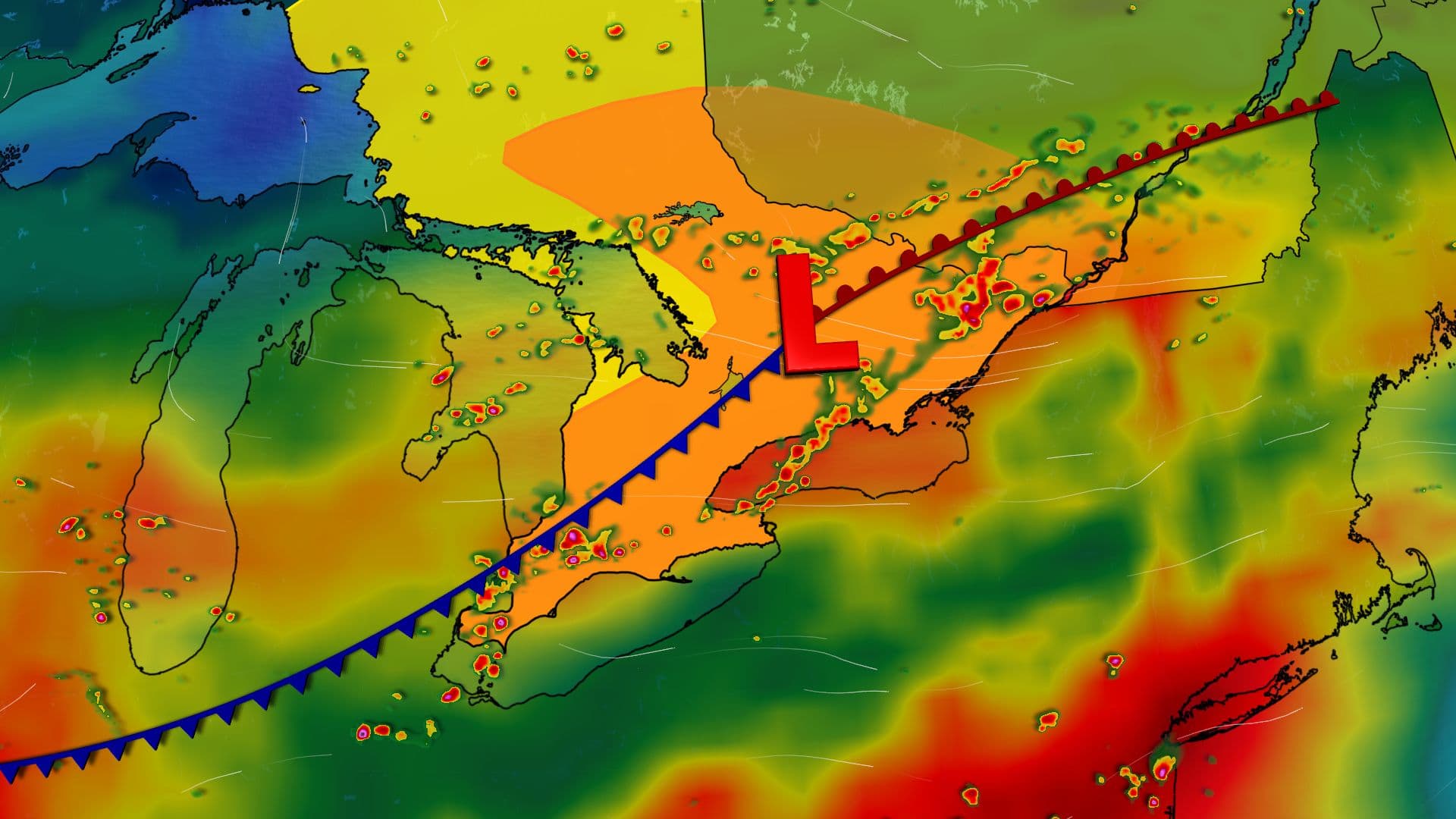
A robust weather system is forecast to bring severe thunderstorms across much of Ontario on Thursday, with meteorologists warning of significant hazards including heavy rain, large hail, and potentially damaging winds. The event is being driven by a combination of a humid air mass, a frontal boundary, and abundant atmospheric moisture, contributing to widespread instability and the potential for intense storms.
Environment Canada and multiple weather outlets have indicated that the risk will unfold in phases throughout Thursday. Rain and embedded thunderstorms are expected to begin Thursday morning over northeastern and eastern Ontario, developing along a warm front. By early afternoon, the advancing main low pressure system is expected to destabilize the atmosphere over southern Ontario, increasing the likelihood of severe thunderstorm activity.
The Weather Network and Yahoo News Canada report that a warm, humid air mass with humidex values reaching the mid-30s is a key factor in the storm's intensity. Severe storms are forecast to initiate near the Lake Huron shoreline around 11 a.m., moving eastward to reach the Greater Toronto Area (GTA) between 1 and 2 p.m. This timing places several major highway corridors, including the 401, 404, and 400, at risk for storm impacts during peak travel hours.
In southern Ontario, the primary hazards include torrential downpours, strong wind gusts, and hail that could reach the size of toonies. According to Environment Canada forecasts relayed by INsauga, these thunderstorms could bring up to 30 mm of rain locally overnight and into Thursday morning, with the potential for locally higher amounts as the system progresses.
Most of the region, including the GTA, Hamilton, Niagara, London, and Windsor, is listed as being at risk for thunderstorms capable of torrential rainfall and gusty winds. Environment Canada notes that heavy rainfall will likely have the greatest impacts in urban centres and areas with poor drainage, raising the risks of flash flooding, water pooling on roads, and possible downed trees.
Further east, eastern Ontario and Ottawa are expected to face linear storm patterns by late afternoon and evening, with the possibility of damaging wind gusts approaching 100 km/h. Commuters in Ottawa are advised to anticipate stormy conditions during the evening rush hour.
The Bruce Peninsula, Huntsville, and Ottawa are also expected to experience thunderstorms, with up to 50 mm of rain possible locally in these areas. However, Environment Canada did not specifically mention gusty winds for these regions. Areas further north, such as Sudbury, may see isolated thunderstorms and up to 20 mm of rain, while northwestern Ontario could encounter isolated or scattered storms Friday afternoon and evening.
Thunderstorm activity is expected to persist into Friday morning for portions of southern Ontario, with rainfall totals reaching up to 40 mm in some locations. The staggered timing and wide geographical spread of the threat highlight the potential for both localized and broader impacts.
The severe weather risk is closely linked to the atmospheric setup: a warm front brings initial morning precipitation, while the arrival of a main low pressure system in the afternoon enhances instability, particularly as it interacts with the humid air mass. This combination increases the likelihood of severe convection, with large hail and strong winds as additional threats.
Meteorologists caution that the evolving nature of the system necessitates close monitoring of weather alerts and updates throughout the day. The potential for localized flooding, especially in urban areas and zones with poor drainage, is a recurring concern cited by forecasters.
Authorities and weather services are advising residents to remain vigilant as the situation develops, with particular attention to high-impact areas and times. The risk to major transportation corridors and the possibility of rapid-onset hazards such as flash flooding or downed trees underscore the need for preparedness and timely response.
The severe weather threat arrives during a period when muggy, summer air masses are common in Ontario, and such systems can lead to a variety of hazards, from drought and heat to localized floods. The current forecast underlines the complex and often volatile nature of summer weather in the region, where rapid changes in atmospheric conditions can result in significant impacts for communities across the province.