Severe Storms and Tornado Warnings Sweep Eastern Alberta
Tornado touches down near Dillberry Lake as large hail and damaging winds strike central and northern regions
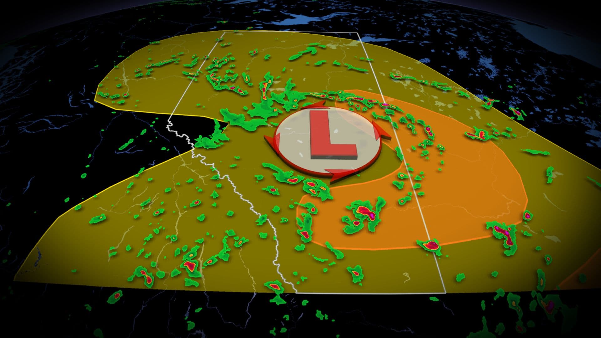
A significant severe weather event unfolded across central and eastern Alberta on Wednesday, as a low-pressure system triggered the development of thunderstorms capable of producing large hail, damaging winds, and tornadoes. The system, which also affected parts of Saskatchewan and northeastern British Columbia, prompted a series of weather alerts and emergency responses in several communities.
Environment Canada issued a critical tornado warning at 7:23 p.m. for eastern Alberta, specifically near Paradise Valley, Chauvin, Provost, and the Municipal District (MD) of Wainwright. The warning cited meteorological observations of a tornado forming near Paradise Valley, located southwest of Lloydminster. Residents were advised to take immediate cover as the situation was described as "very dangerous and potentially life-threatening."
Shortly after the alert, a tornado touched down near Dillberry Lake Provincial Park, approximately 290 kilometres east of Edmonton. Alberta RCMP spokesperson Cst. Sandra Geiger reported that officers were dispatched to the area at about 8:30 p.m. in response to the tornado, though no specific details regarding damage or casualties were available at the time. The MD of Wainwright urged the public to avoid the area to allow emergency crews to operate.
The tornado warning was lifted at 8:48 p.m. as the storm system moved east into Saskatchewan. During the period of heightened alert, residents in the MDs of Wainwright and Provost, about 200 kilometres southeast of Edmonton, were warned to prepare for extreme winds, large hail, and intense local rainfall. Laurie Penner, a resident of Chauvin—over 18 kilometres northwest of Dillberry Lake—described observing the tornado's rotation from her front deck, noting the rapid progression of the storm and the sudden occurrence of quarter-sized hail and strong, though brief, winds following a close lightning strike.
Across central and northern Alberta, including Edmonton, Slave Lake, Cold Lake, Fort McMurray, and as far north as Hay River in the Northwest Territories, severe thunderstorms developed through the late afternoon and evening. The primary meteorological triggers were the low-pressure system and an amplified trough, which created conditions for the formation of a mesoscale convective system (MCS). This system was responsible for the severe storm line along the Alberta-Saskatchewan border, bringing the risk of very large hail—potentially golf ball-sized (three to six centimetres in diameter)—and damaging wind gusts of up to 110 km/h.
Environment Canada placed Edmonton and much of the Capital Region under a thunderstorm watch, with the city experiencing a temperature of 22°C at 1 p.m. and wind speeds of 12 km/h from the north. The forecast for the day indicated a mix of sun and cloud, a 30 percent chance of showers, and a risk of severe thunderstorms. Winds were expected to become northwesterly at 20 km/h, gusting to 40 km/h, with a daily high of 24°C. The UV index was measured at 6, categorized as high.
Chloe Katsademas, a meteorologist with Environment Canada, explained that a frontal system moving through Alberta was responsible for triggering showers and thunderstorms in central and southern regions. She noted that the thunderstorms over Edmonton were expected to develop in the early to mid-afternoon and could produce large hail and strong winds. Katsademas further clarified that hail was forecast to range from three to six centimetres in diameter, with one-centimetre hail considered small and pea-sized.
The recent rainfall patterns in Edmonton have set historical precedents. The city broke a 112-year-old June rainfall record last month, surpassing the previous 216.5 mm record set in 1914, and came close to the all-time monthly record of 282 mm from July 1901. The saturated ground increases the likelihood of further significant thunderstorms and more severe weather events, according to meteorologists.
Winds strengthened across northeastern British Columbia and parts of the Prairies on Wednesday, with gusts reaching up to 60 km/h in the afternoon. While central and northern Alberta were at risk for severe storms, southern Alberta experienced a drier weather pattern, with temperatures projected to return to near 30°C by the weekend.
Visuals of the storm were widely shared on social media by weather watchers, documenting the formation and movement of the tornado and associated severe weather. As of 9 p.m., there were no reports of major damage in the affected areas, though emergency services continued to respond to incidents near the tornado’s path.
Tornado warnings are issued when a thunderstorm is producing or is likely to produce a tornado, according to Environment Canada. The agency advises residents in affected areas to seek shelter and remain alert to changing weather conditions. The warning system employs a colour-coded approach, with yellow indicating a thunderstorm watch and orange signifying a slight risk of tornado activity.
Local authorities emphasized public safety during the event. The MD of Wainwright, in a public statement, asked residents to stay clear of the affected area near Dillberry Lake to facilitate emergency response efforts. Residents were also reminded of the importance of heeding weather warnings, as rapidly changing conditions can result in hazardous situations, including hail, intense rainfall, and strong winds.
The occurrence of severe thunderstorms and tornadoes in Alberta is not uncommon during the summer months, particularly in areas where atmospheric instability is enhanced by large-scale weather systems. The recent episode underlines the continuing need for preparedness and timely response to weather-related hazards in the region.