Harvest Progress Interrupted by Unstable Weather Across Manitoba and Saskatchewan
Rainfall, storms, and warm fall outlooks create mixed prospects for Prairie farmers
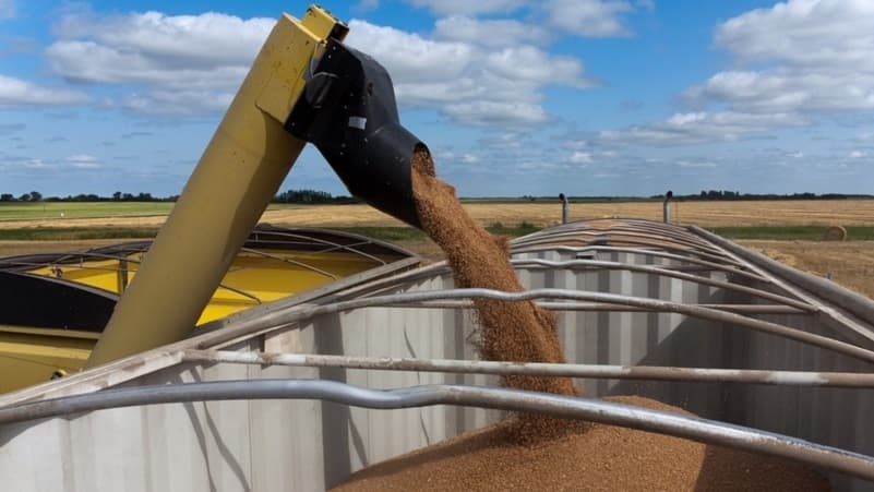
Harvest operations across Manitoba and Saskatchewan have experienced interruptions due to recent episodes of inclement weather, with rainfall and thunderstorms producing localized impacts on crop progress. In Manitoba, isolated thunderstorms brought strong winds and intense rain across various regions during the last week of August. Sonia Wilson, an oilseed specialist, noted that the bulk of this precipitation occurred on August 30 and 31. She reported that 'it has been kind of stop and go with harvest depending on how much rainfall has been received.' At least one tornado was confirmed near Elkhorn, Manitoba, as part of these storms. Despite these interruptions, most winter cereals have been completely harvested throughout the province, with only a small amount of winter wheat remaining to be finished in the southwest.
In Saskatchewan and parts of Manitoba, unwelcome harvest rains have raised concerns over crop quality and the timing of field operations. The variability and intensity of rainfall have contributed to challenges for producers, especially where the precipitation was heavier or more prolonged. Strong winds associated with the thunderstorms have also been noted as a factor affecting crop stands and potentially increasing the likelihood of lodging or shattering, which can impact both yield and quality.
Forecasts indicate that southern Manitoba is likely to experience a fall season warmer than the historical norm. David Phillips, Senior Climatologist with Environment Canada, stated that the meteorological fall, spanning September 1 to November 30, is expected to continue the pattern observed in recent years. Phillips emphasized that while September temperatures are on average six degrees cooler than August, recent autumns have been consistently among the warmest in the last eight decades. The fall of 2025 was the warmest on record in southern Manitoba over the past 80 years, with the fall of 2024 ranking second. The last five fall seasons have all placed in the top ten warmest during this period, with average temperatures at least four degrees above normal in the warmest years.
Phillips observed that these warmer falls have extended summer-like conditions further into the autumn months, simultaneously delaying the onset of winter conditions. He noted, 'It's almost like room temperatures. You are not spending money on your air conditioning; you have not got your heat on.' This trend has implications for the agricultural calendar, potentially affecting the length of the growing and harvest seasons as well as post-harvest field work.
While the outlook for temperature is relatively clear, Phillips acknowledged greater uncertainty around precipitation, though he expects at least September to be wetter than usual. He cautioned, 'It's hard to get precipitation right tomorrow. Let alone on the weekend or let alone a month or three months from now.' Despite the warmer pattern, the threat of frost remains a factor; nine out of ten years see frost during September in southern Manitoba, though 2025 was an exception with the first frost occurring on October 7 and the first killing frost in mid-October. Lasting snowfall in 2025 did not occur until after Remembrance Day.
Short-term weather patterns continue to produce variability in harvest conditions. Colleen Bready, a meteorologist with CTV News, reported that storm systems crossing from North Dakota into southern Manitoba are generating rain and thunderstorms, with the risk of severe convection not entirely excluded for the region. Environment and Climate Change Canada identified damaging hail and wind gusts as the main hazards, with a low-grade tornado risk possible in the southwest. Thunderstorms are being fuelled by elevated humidity, producing humidex values in the upper 20s to low 30s, while air temperatures range from the low 20s in the southwest to mid-20s in the southeast of the province.
Thunderstorm activity is expected to intensify across Winnipeg and southeastern Manitoba through Thursday afternoon and evening, although the highest risk of severe weather remains to the south in North Dakota. High pressure over northern Manitoba is bringing more stable conditions further north, with unseasonably warm daytime highs reaching the low 20s. Similar conditions are being observed across northwestern Ontario, although warmer temperatures in the mid-20s are reported in that region. The forecast suggests that some communities, such as Kenora and Dryden, may avoid thunderstorms, while areas like Sioux Lookout and Fort Frances could see storm activity during the night.
Looking ahead to the immediate future, the Labour Day weekend in southern Manitoba is forecast to be variable, with overnight lows not expected to fall into single digits and no frost anticipated in the short term. Daytime highs should remain between 23 and 26 degrees, but some shower activity is possible Friday night and into Saturday. Phillips advised that while the autumn will likely remain warmer than usual, precipitation patterns remain less predictable.
Producers remain attentive to both the risks and opportunities these weather patterns present. Warmer fall temperatures may allow for extended fieldwork and potentially longer windows for harvest, but intermittent rainfall and storm events can complicate the process, affecting both crop quality and the logistics of getting crops off the field in a timely manner. The potential for frost, though delayed in some recent years, continues to pose a risk to crops that remain unharvested late into the season.
The current weather variability highlights the ongoing challenges faced by Prairie farmers, who must adapt to both short-term weather events and longer-term climatic trends. The balance between warmer autumns and increased precipitation, as well as the unpredictability of severe weather events, underscores the complexity of agricultural planning in the region. As the harvest season progresses, producers will continue to monitor forecasts and field conditions closely to mitigate risks and optimize outcomes for their crops.
The evolving climate in southern Manitoba, as described by Phillips, is characterized by a gradual shift that has reduced the duration and severity of early winter conditions, while also changing the patterns of frost and first snowfall. These developments are being observed alongside increased frequency and ranking of warm fall seasons, contributing to a new set of considerations for agricultural operations on the Canadian Prairies.