Central Alberta Faces Torrential Rainfall, Flood Risk Amidst Record-Setting June
Environment Canada issues orange-level warnings as saturated ground, thunderstorms raise threat of flooding and infrastructure impacts
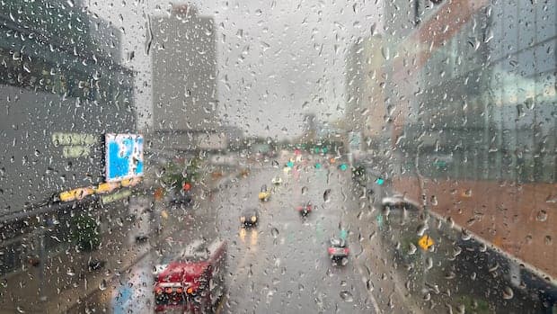
Communities across Edmonton and central Alberta are experiencing a period of unusually intense rainfall, with Environment Canada issuing orange-level rainfall warnings for the region. Forecasts indicate that between 40 and 70 millimetres of rain are expected to fall over the weekend, compounding the effects of a month that has already seen well above normal precipitation.
The orange weather alerts signify a severe storm system with the potential to cause widespread damages or disruptions. The rainfall warnings are in effect for the City of Edmonton, Sherwood Park, St. Albert, and a broad swath of central Alberta that includes communities from Fox Creek and Edson to Vermilion and Wainwright. In addition to rainfall warnings, severe thunderstorm watches have been issued for northwestern Alberta, warning of strong winds, large hail, and heavy rain, particularly on Friday evening.
Environment and Climate Change Canada (ECCC) meteorologists have highlighted that the ground in central Alberta is already saturated from recent storms, notably a substantial deluge in the preceding week. This saturation, combined with above-average rainfall totals for June, increases the risk of overland flooding, washouts, and impacts to infrastructure and property. Scattered showers and thunderstorms are forecast to begin Friday night, developing into a broad area of heavy rain by Saturday morning, with the heaviest downpours expected that day. Rainfall is predicted to continue through the weekend.
Weather outlooks from the ECCC Storm Prediction Centre show central Alberta under the risk of strong thunderstorms, with some areas, particularly along the central Foothills and north of Calgary and in the Grande Prairie region, facing wind gusts up to 90 kilometres an hour and hail as large as four centimetres in diameter. Rainfall totals in these areas could reach 50 millimetres. Southeastern Alberta, including Medicine Hat, is also at risk for wind gusts up to 90 kilometres an hour and hail up to three centimetres, with similar rainfall projections. Other cities such as Edmonton, Calgary, Lloydminster, Peace River, and High Level may see thunderstorms producing wind gusts up to 70 kilometres an hour, hail up to two centimetres, and rainfall totals up to 50 millimetres.
Environment Canada meteorologist Jennifer Kowal noted that Edmonton typically receives between 70 and 75 millimetres of rain in June. However, as of the most recent data, the region has recorded just over 200 millimetres since the month began, nearly three times the norm. This places June 2026 among the wettest on record for the city, matching the second-rainiest June recorded in 1965. The wettest June on record remains 1914, with 216.5 millimetres of rain. These conditions have pushed municipal wastewater management systems to capacity and resulted in emergency alerts, flooded basements, sewer back-ups, and washed-out roads.
Residents have been urged to reduce non-essential water use as municipal crews respond to emergencies caused by the pervasive wet weather. Drivers are being reminded to avoid flooded roads and to monitor local weather updates closely due to the risk of rapid changes and hazardous conditions.
The persistent rainfall is not only an urban concern. Agricultural communities are also feeling the effects. John Guelly, a farmer in Westlock County north of Edmonton, reported over 128 millimetres of rain at the Dapp monitoring station since June 1. While the precipitation has alleviated previous drought-like conditions, Guelly described the fields as muddy, saying, “It’s frustrating because we’d like to get out there. Farmers are typically fixers and there’s nothing you can fix when there’s too much rain or not enough rain.” He noted that irrigation is not an option in his area.
The constant downpour has begun to affect farm output. While the rain was initially welcome, Guelly and other producers now express concerns about the negative impacts of excessive moisture on field access and crop health. Regional farmers are accustomed to weather variability, but the recent pattern of alternating drought and heavy rain has tested their resilience.
Meteorologists attribute the current weather pattern in part to a rare atmospheric phenomenon known as a 'Rex Block'. Such patterns can lead to prolonged periods of wet or dry weather, contributing to the persistent rainfall over central Alberta.
While central Alberta braces for more rain, communities in northern Alberta are experiencing a different weather challenge. Heat warnings remain in effect across the north, with daytime highs forecast between 29°C and 31°C and overnight lows near 14°C expected into early next week. Authorities have advised residents and visitors to take precautions against heat exposure for both themselves and their pets.
This combination of saturated ground, additional heavy rainfall, and severe thunderstorms has increased the risk of overland flooding, infrastructure damage, and property loss. Authorities continue to monitor the situation and issue updated warnings as conditions evolve. The situation underscores the volatility of weather in the region and the challenges faced by both urban and rural communities in adapting to rapidly changing and record-setting precipitation patterns.